Meteomatics Strato Breaks New Ground in Atmospheric Exploration
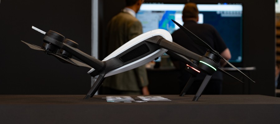

Meteomatics is setting new standards in meteorological data collection: At the Meteorological Technology World Expo 2026, the company will present Strato, the next generation of its weather drones. The system reaches altitudes of up to 12 kilometers and captures vertical atmospheric profiles in areas that were previously difficult to access. This positions the drone as a powerful and sustainable alternative to traditional radiosondes.
The ability to reach altitudes of up to 12 kilometers enables the collection of critical observational data from atmospheric layers that are crucial for the quality of modern weather models. While conventional weather balloons are typically lost after ascent, autonomous drones offer the advantage of reusability: once recharged, the systems are immediately ready for deployment again. This allows for a significantly higher frequency of measurements of temperature, humidity, air pressure, and wind, leading to a more precise representation of local weather events.
Dr. Martin Fengler, founder and CEO of Meteomatics, emphasizes the importance of this technological advancement: “With Strato, we are pushing the boundaries of what weather drones can achieve today. The more high-quality observational data from the atmosphere is available, the more accurately weather models can depict local weather events.”
Comprehensive Data Platform
In addition to the new drone, Meteomatics is showcasing its entire technology portfolio at the trade show, which covers the entire weather forecasting process. This includes the high-resolution weather models EURO1k and US1k, which enable hyperlocal forecasts with a resolution of one kilometer. The offering is complemented by the Weather API for fast data access, as well as the MetX platform, which visualizes and analyzes meteorological data using AI. The components are modular in design but achieve their full potential when working together.
Relevance for the Drone Industry
The launch of Strato is a groundbreaking milestone for the industry, as it marks the transition from drones as purely observational tools to indispensable instruments for global climate research and critical infrastructure. For the drone industry, this advancement underscores the potential of autonomous systems in highly complex, regulated airspaces.
Furthermore, Meteomatics demonstrates how the vertical integration of hardware—the drone—and software—the AI-powered analysis models—creates genuine added value for government weather services and the private sector. This holistic approach offers manufacturers and service providers a blueprint for how specialized unmanned systems can be integrated into existing industrial value chains through data sovereignty and process optimization.
If you use Google as your search engine, you can set Drones as your preferred source so that our content appears more frequently in your search results. Add Drones as your preferred source.