Quantum Systems Teams Up with SONY to Enhance Drone Imaging with 61-Megapixel Camera Integration for Trinity Pro UAV
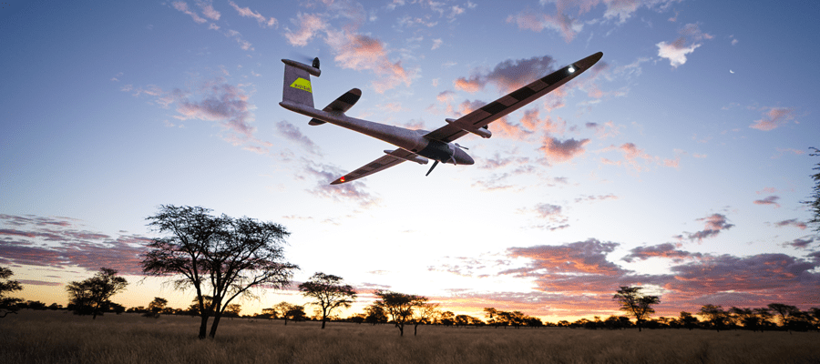
Munich, Germany - October 10, 2023 - Quantum-Systems GmbH, the leading Munich-based innovator in dual-use drones employing state-of-the-art multi-sensor technology for governmental and commercial clients, proudly announces a monumental leap in aerial imaging technology. The company unveils its collaboration with global technology giant Sony to seamlessly integrate the Sony ILX-LR1 61-megapixel camera into its flagship Trinity Pro mapping drone.
Remaining at the forefront of innovation while responding to customer needs
In response to the surging demand for high-resolution imagery in commercial surveying and mapping applications, Quantum Systems has harnessed the formidable power of the Sony ILX-LR1 full-frame 61-megapixel camera to take the Trinity Pro’s capabilities to the next level. As the industry swiftly transitions from 42-megapixel cameras to 61-megapixel standards, Quantum Systems ensures that it remains at the forefront of innovation.
An industrial-grade camera tailored to drones allowing quicker project turnaround
The Sony ILX-LR1 camera allows for seamless, deep integration into Quantum Systems drones and autopilots, enabling direct remote control and direct georeferencing. Purpose-built to cater to a wide range of commercial mapping applications, the camera offers uncompromising image quality, accuracy, and coverage. Stripped of many of its on-body buttons and controls, the camera is particularly light and versatile.
Equipped with next-generation sensors and BIONS processor, the camera achieves rapid data readouts, capturing up to 3 frames per second for improved forward overlap. Through innovative Image ID technology timestamps each picture appends native date information, facilitating precise image stitching and mitigating data loss risks through direct geo-referencing.
The Trinity Pro paired with the ILX-LR1 can survey a staggering 491 hectares based on 90 minutes flight time and 100 meters above ground level flight altitude, boasting a total GSD of 1.8 centimeters per pixel. This translates to faster surveys over larger areas with higher data accuracy.
Im Drones PR-Portal erscheinen Nachrichten und Meldungen von Unternehmen aus der Drone-Economy. Für die Inhalte der Pressemitteilungen sind die jeweiligen Unternehmen verantwortlich.


