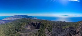
Human-caused climate change has led to more frequent and intense natural disasters in many regions. To quickly address the consequences and optimize protective measures in vulnerable areas, a rapid, accurate assessment is crucial. In this regard, drones can provide extremely valuable assistance, as demonstrated by an example from La Palma. There, after a volcanic eruption in 2021, a digital twin and a new official map of the terrain were created based on 14,000 drone images.

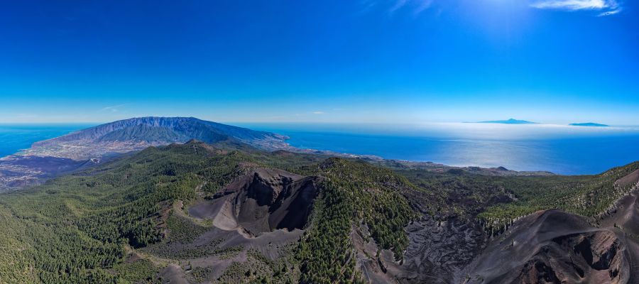
It was the most devastating volcanic event on La Palma in the last 500 years. When the volcano, which forms the so-called Cumbre Viera Ridge on the Spanish Canary Island, awakened after a 50-year period of rest, magma emerged from the depths of the archipelago for over 85 days.
The glowing hot mass was ejected up to 500 meters into the sky. A lava flow crossed the island, destroying not only about 350 hectares of banana plantations but also entire villages. After weeks of eruptions, approximately 12.4 square kilometers of territory were covered with cooled lava, more than 2,500 houses were destroyed, and 7,000 residents lost their homes. Fortunately, the volcanic eruption did not claim any lives, but the local authorities estimated the damage to the island’s infrastructure at nearly 850 million euros.
New map footage
To take stock and assess how the volcanic eruption has altered the topography, the responsible National Geographic Institute (Centro Nacional de Información Geográfica, CNIG) was commissioned to produce new map footage. „The project was about obtaining a realistic landscape representation of the new orography of La Palma after the changes“, explains Celia Sevilla, Head of Inter…