42 Technology and Omnisense collaborate on safer autonomous drone landing system

42 Technology (42T) has played a central role in helping Omnisense, a company specialising in terrestrial positioning technology, to demonstrate a safer autonomous drone landing system when satellite navigation signals are unreliable. The system uses a ground-based Ultra-Wideband (UWB) positioning technology and has been developed by Omnisense through its European Space Agency-supported DroneHome programme.
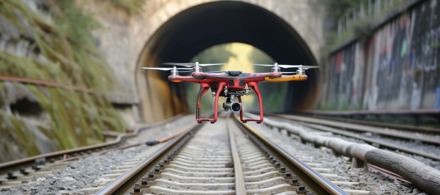
Autonomous landing is one of the most safety-critical phases of any drone mission and is particularly challenging when a device’s satellite navigation system is impaired due to signal obstruction, reflection, or interference. For example, when operating near tall buildings, in busy ports, or inside tunnels. The DroneHome programme has shown how terrestrial radio positioning can function as a complementary navigation layer within the overall navigation system, so a drone’s position remains stable and predictable even in GNSS-challenged environments where satellite signals are degraded or even absent. In practice, this means autonomous systems can maintain controlled behaviour instead of experiencing sudden navigation failures.
One of the key technical challenges was extending the operational range of UWB positioning to make it viable for autonomous landing. 42T worked closely with Omnisense to design and develop the extended-range RF hardware used in both the ground infrastructure and airborne elements of the system. The front-end design incorporates a UWB system-on-chip with low noise amplification, power amplification, switching, and antenna integration to deliver the required range and performance.
Field trials and simulation-based analysis confirmed that the system maintained stable positioning within a defined envelope during GNSS-degraded operation, enabling reliable autonomous approach and landing.
“We were delighted to support Omnisense in delivering its ground-breaking DroneHome project. GNSS underpins many of today’s critical systems, so developing a terrestrial positioning technology for more reliable autonomous operations in challenging environments is a major advance for drone safety,” said Paul Bearpark, Head of Electronics and Software of 42 Technology.
“DroneHome demonstrates that terrestrial radio positioning can provide a reliable and predictable navigation layer when GNSS signals cannot be relied upon,” said Andy Thurman, CEO of Omnisense. “This is an important milestone in building more resilient autonomous systems that can maintain safe operation in real-world conditions.”
The results from Omnisense’s DroneHome programme are directly relevant across a wide range of applications, including airborne, terrestrial and maritime operations, infrastructure inspection, and autonomous systems operating in GNSS-challenged environments.
Omnisense is now working with partners to explore deployment of this capability within operational systems, with the aim of integrating it into next-generation navigation architectures and autonomous platforms.
About DroneHome
The DroneHome development programme was led by Omnisense and supported by the European Space Agency (ESA) through its Navigation Innovation and Support Programme (NAVISP).
The objective was to explore the use of extendedrange UWB terrestrial positioning to improve autonomous landing and navigation resilience in GNSSchallenged environments. It focused on validating the system architecture, infrastructure optimisation and synchronisation techniques needed for highaccuracy positioning alongside GNSS and onboard sensing. For further information see omnisense.co.uk/dronehome
Terrestrial positioning technology
This is a ground-based navigation and positioning system that uses land-based transmitters (such as Wi-Fi access points, the 5G infrastructure or dedicated beacons) to determine a device’s precise location rather than relying on satellites.
GNSS versus GPS
GNSS (Global Navigation Satellite System) is the overarching term for all satellite navigation constellations including GLONASS (Russia), Galileo (Europe), GPS (USA) and various regional systems.
GPS stands for Global Positioning System and is essentially the American satellite constellation. GPS tends to be used colloquially for consumer navigation applications, whereas professional, agricultural and high-performance drone applications almost exclusively refer to the use of multi-GNSS.
About 42 Technology
42 Technology (42T) is a product design and innovation consultancy, based near Cambridge (UK), that helps create technically advanced new products and enhanced manufacturing processes for some of the world’s best-known brands, as well as start-ups and SMEs. It works across five industry sectors: consumer, energy, medtech, life sciences, and industrial.
The company was founded in 1998 and has established a strong reputation for partnering with its clients to solve complex technical problems and develop brilliantly successful products. The team comprises engineers, scientists and designers, and offers a diverse range of skillsets that includes ethnographic research and usability engineering, product and system design, device testing and regulatory compliance.
About Omnisense
Omnisense develops terrestrial positioning technology designed to operate alongside GNSS within integrated navigation systems. Its architecture uses time-synchronised radio measurements between fixed infrastructure and mobile platforms to provide accurate and reliable positioning in environments where satellite signals are degraded or unavailable.
The technology is integration-ready and supports a range of applications including autonomous systems, infrastructure monitoring, and research deployments. Omnisense works with partners to incorporate its positioning capability into operational systems, enhancing resilience and enabling predictable performance across challenging environments.
If you use Google as your search engine, you can set Drones as your preferred source so that our content appears more frequently in your search results. Add Drones as your preferred source.
The Drones PR portal features news and reports from companies, universities, and associations. The respective organisations are responsible for the content of their press releases.