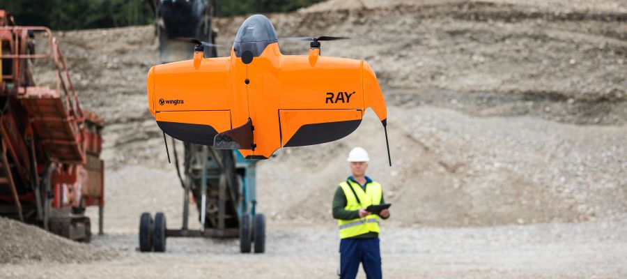
The Swiss company Wingtra is internationally renowned for its precision, efficiency, and innovation in airborne data collection with VTOL fixed-wing drones. Moreover, the globally active company offers an end-to-end solution for decentralized work, encompassing not only the flight system itself but also mission planning, data collection and processing, and the preparation and provision of the desired information.

The path to the future business model and company founding was nearly classical. Long story short: a need was identified, and a tailored solution was conceived. However, the process wasn’t as straightforward or quick for Wingtra.
At the outset, the question was how to implement UAS-based surveying and mapping projects as efficiently as possible. While there were different approaches about ten years ago, unmanned systems were still far from being established tools in geodesy. Multicopters were easy to handle but quickly reached their limits in terms of operational duration and area performance. Traditional fixed-wing aircraft offered range but were more complex to use and required suitable takeoff and landing areas. What was missing was a system that harmonized efficiency, safety, precision, and user comfort.
Comprehensive solution
With its market entry in 2017, Wingtra launched its first drone platform, combining the aerodynamic advantages of a fixed-wing aircraft with the flexibility of a vertically takeoff and landing system. This filled a technological gap that had rendered drones unattractive for many surveying tasks. In the years that followed, Wing…